|
Day Nineteen |
June 17, 2007 |
Pocatello, ID to Cheyenne, WY |
I had been considering two plans for the final days of our vacation. Both routes started out collecting three counties in southeastern Idaho and then following U.S. 30 to I-80 in Wyoming. The plans diverged at Rawlins. Plan A was to head north on U.S. 287 and collect a dozen counties in Wyoming and Nebraska before returning to I-80 at North Platte. Plan B was more conservative, simply driving I-80 across Wyoming and Nebraska without collecting more counties. I really wanted to follow Plan A.
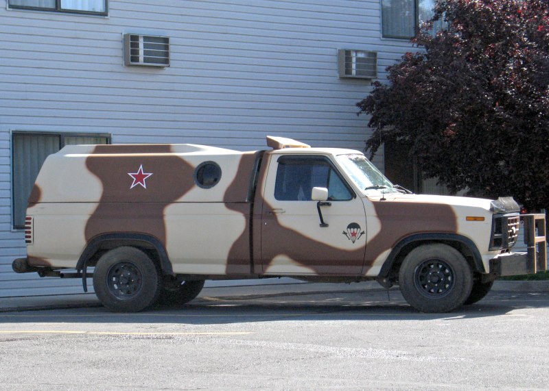
The first thing I saw when I walked out of the Super 8 this morning was this vehicle. Could it be one of those Idaho militiamen I had heard so much about?
Our early morning start was spoiled by a long wait for breakfast at Elmer's. We were seated promptly, but the kitchen was frustratingly slow with our order. My wife suggested we just walk out, but I was too hungry to go. I had to eat somewhere, and we didn't have time to start all over again at another restaurant. By the time we left Pocatello, we were behind schedule. Road construction on U.S. 30 didn't help. Although there were no workers on Sunday, the 45 mph speed limit in what was normally a 65 mph zone cost us time. Plan B was looking better.
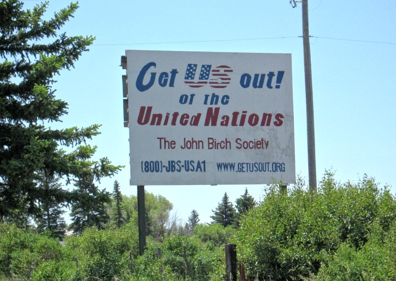
Our welcome to Montpelier was a billboard from the John Birch Society urging the United States to withdraw from the United Nations. It was Father's Day, and my dad would have cheered.
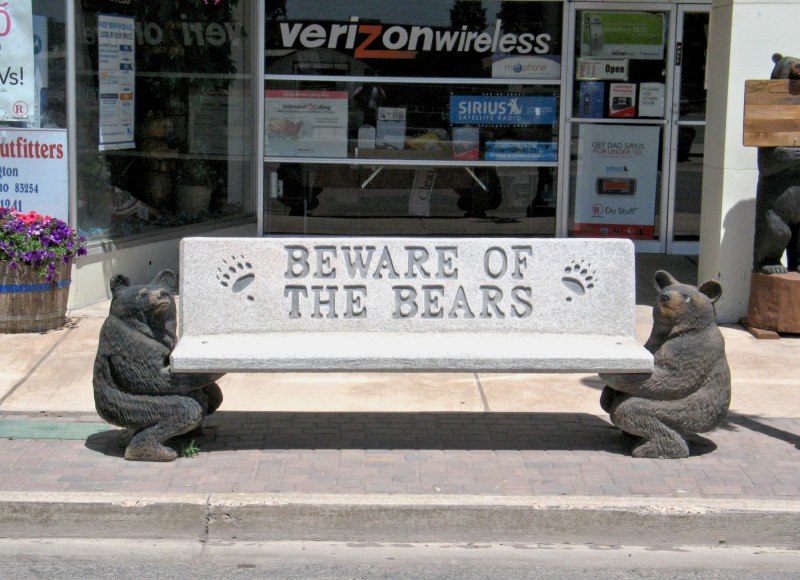
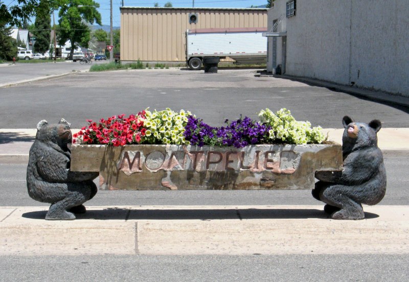
We left U.S. 30 to collect another county. Downtown we saw carved bears holding up benches along Washington Street. I went west through town to ID 36 to collect Franklin County. This would be the last time in the trip for the patented western drive-just-over-the-pass-and-turn-around method of county collecting. When we returned to Montpelier, I photographed the bears, which looked like hairy movers (yet another reminder of my dad on Father's Day).
We stopped at a gas station for drinks, and then we followed U.S. 30 into Wyoming. We passed Fossil Butte National Monument, the second fossil-themed monument that we ignored on the way home.
At Kemmerer, I took the business loop into town. I had visited there in 1993, and I was curious what had changed (for starters, I didn't remember there being a business loop and a bypass route back then). A carhop called King Cone was now a feed store. The downtown triangle (instead of a square) that includes JC Penney's home and his first store seemed the same, except I didn't remember there being a stoplight in front of the JC Penney store. We stopped at the store because I hoped the powers that be had reconsidered their decision not to carry any "mother store"-specific merchandise (I wanted to get something for my mom, who has worked at Penney's for most of her life). Alas, only some postcards distinguished their inventory from that of any other JC Penney store. The pitfalls of centralized purchasing were on full display with a rack of classic rock t-shirts. Surely, the youth of Kemmerer were not clamoring for AC/DC and Black Sabbath t-shirts. Even at half price, they weren't flying off the rack. Perhaps the John Deere shirts were more popular, but maybe not since Kemmerer's big businesses were ranching and oil, not farming.
My wife found a few things to buy. I was going to show her some things, but, well, let's just say 19 days on the road together finally got the best of me (plus I was still a little annoyed that she hadn't hiked with me at Craters of the Moon). I said something, she misunderstood me, I got pissed off, and I stormed out of the store. I learned later that the clerks asked my wife if I was going to leave her there, but of course I didn't. On the way out of town I noted that the Antlers Motel where I had stayed in 1993 was still open. We didn't talk for the next hour, a situation made easier by her decision to take a nap. The rest of the drive to I-80 was marked only by a few oil development sites. Once I reached the interstate, the speed limit rose to 75 mph and I cruised at 80. I woke my wife as I-80 came into Green River, an awesome view of the Wyoming badlands.
Between our long breakfast and our ill-fated stop at the first JC Penney, we had squandered the time I needed to follow Plan A. At Rawlins I didn't even think twice about those extra counties I could collect in central Wyoming and northwestern Nebraska I just pointed the Mazda 6 toward Cheyenne. I told my wife about some of the sights I had seen in the area between Laramie and Cheyenne fourteen years ago, but we didn't have time to revisit them. As we drove into Cheyenne on U.S. 30, the old Lincoln Highway, I saw that the neon sign of the Lincoln Court Motel that I photographed in 1993 was gone. First the neon had been replaced with a backlit sign, but now it looked as though the motel was demolished. The sign only marked a few ruins poking up through the weeds. We passed the chains and stayed at the Guest Ranch Motel. It was a decent room, pleasantly quirky without being irritating. One benefit of Plan B was that Cheyenne had a Shari's. Even better, the motel had a Shari's To Go menu that included a coupon for a free slice of pie.
We drove across town on the old Lincoln Highway, taking in whatever sights there were at an oppressive 25 mph (especially after hours of driving 80 mph on I-80). Shari's was at the east end of town, so we probably saw everything. I had a breakfast platter of some sort; I never ordered dinner at Shari's. Then we split a free slice of Oreo cream pie.
Return to Trip Summary Go to Day 20
Copyright © 2002-2013 David Johnsen. All rights reserved.